


The quake hit east-southeast of Palu, Central Sulawesi province, at 10:27 a.m. (0227 GMT).
There was no risk of a tsunami. However, patients in several hospitals evacuated the building to ensure safety.
What else do we know about the Indonesia tremor?
The initial earthquake was centered 43 kilometers (27 miles) east-southeast of Palu. The US Geological Survey said it was about 10 kilometers deep.
It was followed by several aftershocks, with the strongest being 5.2 magnitude.

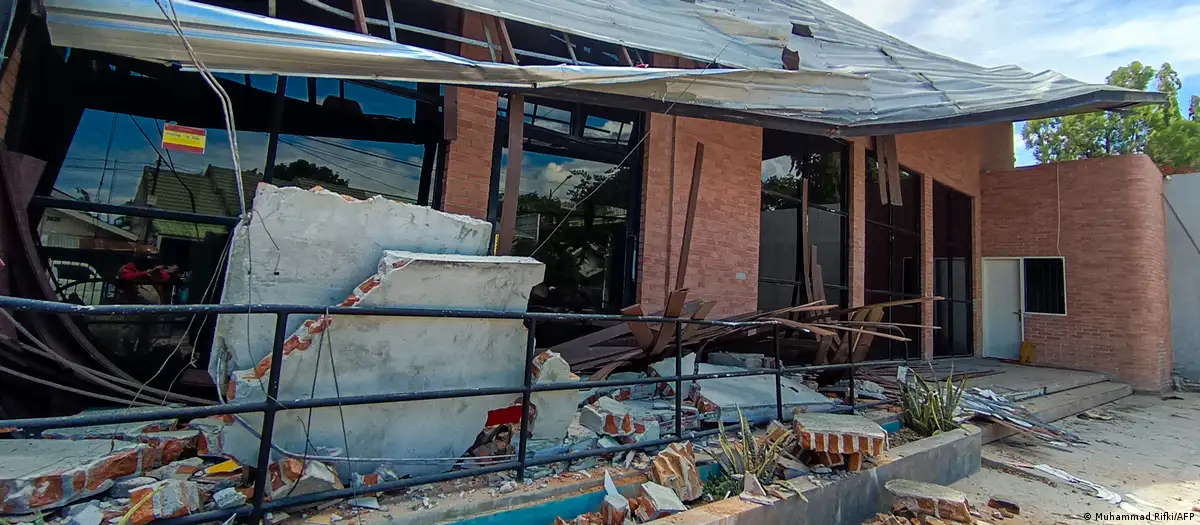
Footage emerging from the affected area showed heavily damaged structures with partially collapsed roofs, shattered walls and scattered debris.
The National Disaster Management Agency said information on the extent of the damage as well as possible casualties or displaced residents was still being collected, dw.com reports.
“We have evacuated all guests from the hotel, including several guests who remained in their rooms,” Effendi Natali, a general manager of a four-star hotel in Palu, told the Associated Press news agency. “They all panicked, which is a natural reaction during an earthquake, but everyone is safe.”
Natali added that the hotel only sustained minor damage.
Indonesia lies on the Pacific “Ring of Fire,” the world’s most geologically active zone, where earthquakes and volcanic eruptions occur regularly.
In 2018, Palu city was struck by a 7.5 magnitude earthquake. The earthquake was followed by a 3-meter (10-foot) high tsunami and a phenomenon called liquefaction in which soil collapses into itself.
Thousands of people were killed, including many who were buried when whole neighborhoods were swallowed as the ground depressed.