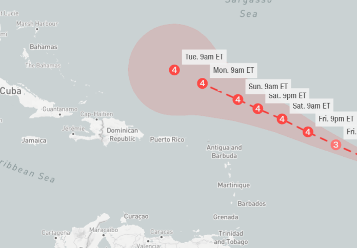
Hurricane Lee was showing signs Thursday morning that it would rapidly intensify again, days before a precarious and uncertain northward track that much of the US East Coast will have to watch closely.
Category 1 storm, packing maximum sustained winds of 80 mph as of early Thursday, could reach near Category 5-strength as it approaches the eastern Caribbean. Lee could near Category 5-strength as it approaches the eastern Caribbean this weekend and is still expected to be a dangerous hurricane over the southwestern Atlantic early next week. Lee’s maximum forecast intensity of 155 mph would make it the strongest storm in the Atlantic basin this season. That forecast is also just 2 mph shy of Category 5.
It’s too soon to know whether this system will directly impact the US mainland, but even if the hurricane stays off the coast, dangerous surf and rip currents will threaten the Eastern Seaboard.
There is increasing confidence that the center of Lee will pass to the north of the northern Leeward Islands, the Virgin Islands and Puerto Rico this weekend and into early next week. There is a potential for tropical storm conditions to occur on some of these islands over the weekend.
Source: CNN


