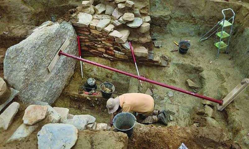
Archaeologists have launched new excavations in western France to try to decipher the Saint-Bellec slab, which was carved four thousand years ago and is considered the oldest map of a region in Europe.
At the site of Saint-Bellec in Louannes in the mountains of Brittany, archaeologist Yvan Payet at the University of Western Brittany said he and his colleagues were seeking to “better determine the context of the discovery, obtain dating elements” and to “verify whether any fragments still exist,” reports Al-Rai daily.
While excavating this grave, Paul de Chatelier (1833-1911) discovered the inscribed tablet in 1900, before it was forgotten for more than a century.
The archaeologist wrote at the time, “We must not let imagination mislead us, and let us leave the matter of reading (the tablet) to some Champollion, who may exist one day,” referring to the French Egyptologist Jean-François Champollion, who succeeded in deciphering the ancient Egyptian hieroglyphic language.
Yvan Payet and researcher Clement Nicolas had previously partially completed this decryption process since they found the painting in 2014, in one of the basements of the National Museum of Antiquities in Saint-Germain-Annelet, on the outskirts of Paris.
Payet recounted that “certain engraved symbols that immediately seemed to make sense” were present from the beginning.
The researchers sought to confirm their initial intuition by conducting a three-dimensional scan of this slab, which measures 2.20 meters by 1.53 meters, to compare it with current maps using a statistical method. It turns out that the slab is 80 percent similar to the current terrain.
Clément Nicole explained that they were able to recognize in the tablet inscriptions “the hydrographic network and the topography of the Black Mountains.” He added, “We still have to get to know all the symbols of geometric shapes, the explanations attached to them, and the methods….”
The most mysterious of these symbols are small circular cavities ranging in diameter from one to ten millimeters that were cut into the slab, which may represent dwellings or geological deposits.
Kleiman pointed out the necessity of conducting a “survey” of the area in order to “match the locations that appear on the map” with what exists on the ground. He expected this task to take “15 years.”
Bayet considered that “relying on the map to try to find archaeological sites is a wonderful method.
“We don’t usually work this way at all.” He described it as a “treasure map.”
This stage, which combines photography from the air or while walking, will provide conclusive evidence of the topographical character of the inscriptions, but it will also allow for a more accurate dating of the map.
Nicholas believed that “the dating of these sites is what will provide a scope for dating the inscriptions.”