


In a major milestone for international space cooperation, the United States and India successfully launched the NASA-ISRO Synthetic Aperture Radar (NISAR) satellite on Wednesday. Described as a “first-of-its-kind” mission, the satellite will map the Earth’s surface with exceptional precision, capturing changes as small as 1 centimeter.
The $1.3 billion (€1.14 billion) mission is jointly led by NASA and the Indian Space Research Organisation (ISRO), with the satellite lifting off at 12:10 GMT from the Satish Dhawan Space Centre in Sriharikota, Andhra Pradesh.
“Congratulations India!” wrote India’s Minister of Science and Technology, Jitendra Singh, on X following confirmation that the satellite had reached orbit.
Now in orbit around Earth’s poles at an altitude of 747 kilometers (464 miles), NISAR is scheduled for a 3-year mission. It will scan the entire Earth every 12 days, monitoring subtle shifts in terrain caused by both natural and human activity. These include melting glaciers, land deformation, subsidence, swelling, volcanic activity, landslides, and wildfires, report international news agencies.
Although it cannot predict earthquakes, NISAR’s data will significantly improve understanding of regions most vulnerable to major seismic events. “We’ll see land subsidence and swelling, deformation and melting of mountain glaciers and ice sheets covering both Greenland and Antarctica,” said Karen St. Germain, Director of NASA’s Earth Science Division. She called NISAR “the most sophisticated radar we’ve ever built.”
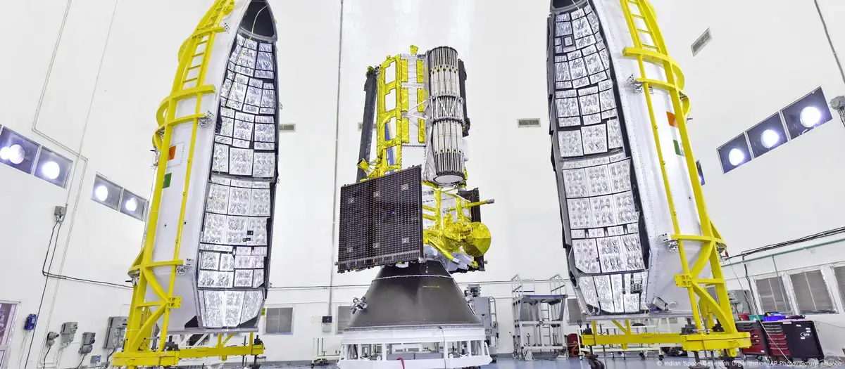
NISAR is the world’s first radar imaging satellite to operate on dual radar frequencies—NASA developed the L-band radar, while ISRO contributed the S-band radar. These radars, capable of operating 24/7 in all weather conditions, beam signals to Earth and measure the reflected echoes using a large antenna reflector.
The satellite’s ability to make detailed measurements regardless of cloud cover or darkness is expected to revolutionize Earth observation. “The potential applications from the satellite are huge, and the global scientific community is eagerly awaiting the satellite data,” said ISRO Chairman V. Narayanan.
“This is not going to be used by just one or two countries. The entire globe is going to benefit from this great accomplishment,” he added.
NASA invested $1.2 billion into the project, contributing the low-frequency radar and large reflector, while ISRO provided the satellite structure and the high-frequency radar with a $91 million investment. NASA Deputy Associate Administrator Casey Swails hailed the launch as a symbol of what “our two nations can do” together.
The mission underscores India’s rising stature in the space sector, following major accomplishments like its 2014 Mars Orbiter and the 2023 Moon rover landing. Most recently, Indian astronaut Shubhanshu Shukla made history by becoming the first Indian to reach the International Space Station.