


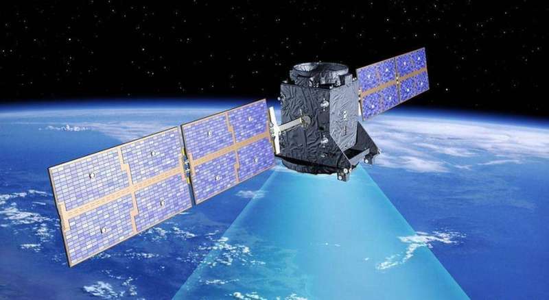
An international mission to install a satellite in orbit, led by the US National Aeronautics and Space Administration (NASA), from Southern California, on a major scientific mission to conduct a comprehensive survey of the world’s oceans, lakes and rivers for the first time.
The radar satellite, which monitors the topography of surface waters and oceans, was designed to provide scientists with an unprecedented view of the waters that cover 70 percent of the Earth’s surface, and provides new insight into the mechanisms and consequences of climate change, reports a local Arabic daily quoting Reuters.
The Falcon 9 rocket, owned and operated by US billionaire Elon Musk, SpaceX, is scheduled to launch before dawn on 15 December from the US Space Force Base Vandenberg, about 170 km northwest of Los Angeles, to carry the satellite into orbit.
If all arrangements go according to plan, the satellite will provide research data within a few months.
The satellite, which was developed over nearly 20 years, uses technology that scientists say is capable of collecting measurements of the length and surface of oceans, lakes, water reserves and rivers in high-resolution detail covering 90 percent of the world.
Researchers said the data, which will be collected by the Planetary Radar Survey at least twice every 21 days, will enhance understanding of ocean circulation patterns, underpin climate projections and help manage scarce fresh water supplies in drought-stricken regions.
“It’s the first mission to monitor almost all the water on the planet,” said scientist Ben Hamlington, who also heads a team involved in studying sea level change at NASA.
One of the most important tasks of the mission is to explore how the oceans absorb heat and carbon dioxide from the atmosphere in a natural way, which leads to global warming and climate change.